Photos in time: what it looks like now
caption
The Oland Brewery in Dartmouth was wrecked by the explosion. Inlaid photo courtesy Nova Scotia Archives.Photos and research by Nader Nadernejad, Maya Palacio and Matt Stickland
King’s journalism students used digital mapping techniques to locate historic buildings damaged or destroyed by the Halifax explosion. They then set out to photograph what those locations look like today. As nearly as possible, the photos were taken at the same geographic locations.
Just about where cars zoom up the approaches to the Macdonald bridge today, was once the location of Halifax’s main railway station. The depot had a glass-roofed train shed that collapsed when the blast wave from the explosion hit. The sidewalk where the railing was located in the historic photograph is behind the concrete barriers and chain link fence. The 1917 photo is from the collection of the Nova Scotia Archives.
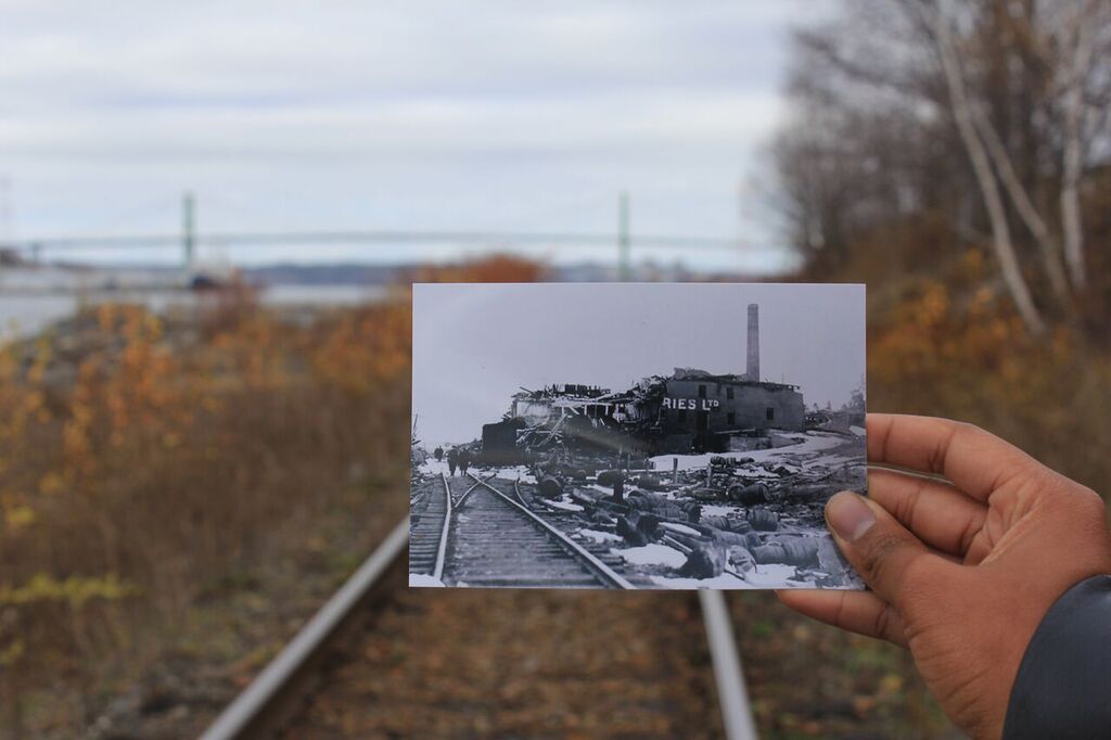
The Oland and Son Ltd. Brewery was located on the Dartmouth shore, almost directly across from the site of the explosion, and was wrecked.
The brewery had been established in 1879.
caption
The Oland Brewery in Dartmouth was wrecked by the explosion. Inlaid photo courtesy Nova Scotia Archives.
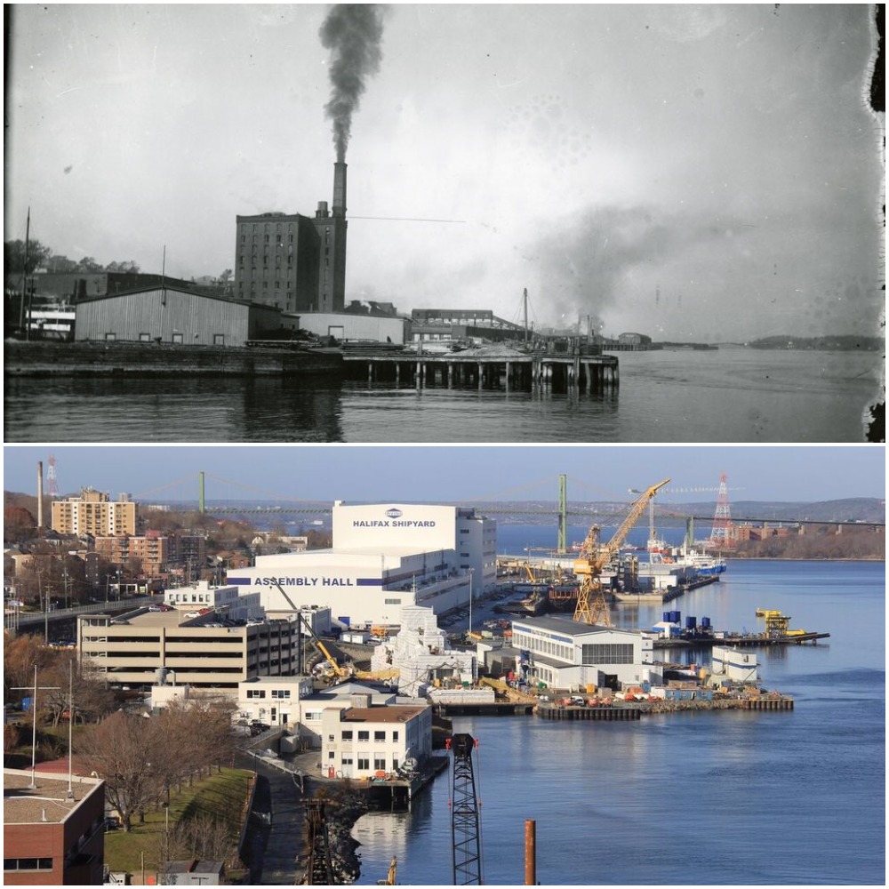
The Acadia Sugar Refinery was a landmark at the foot of the Richmond neighbourhood in Halifax. The explosion destroyed the building. People who had gone to the roof to watch the burning Mont Blanc were among those killed. Today, Irving Shipbuilding operates on the site.
caption
The location of the Acadia Sugar Refinery in 1917 and today.St. Joseph’s Roman Catholic Church was located on Gottingen Street between Kaye and Russell streets and was demolished by the explosion. Today, it is the site of a housing development. What is now the Shambhala School can be seen in the background of both photographs.
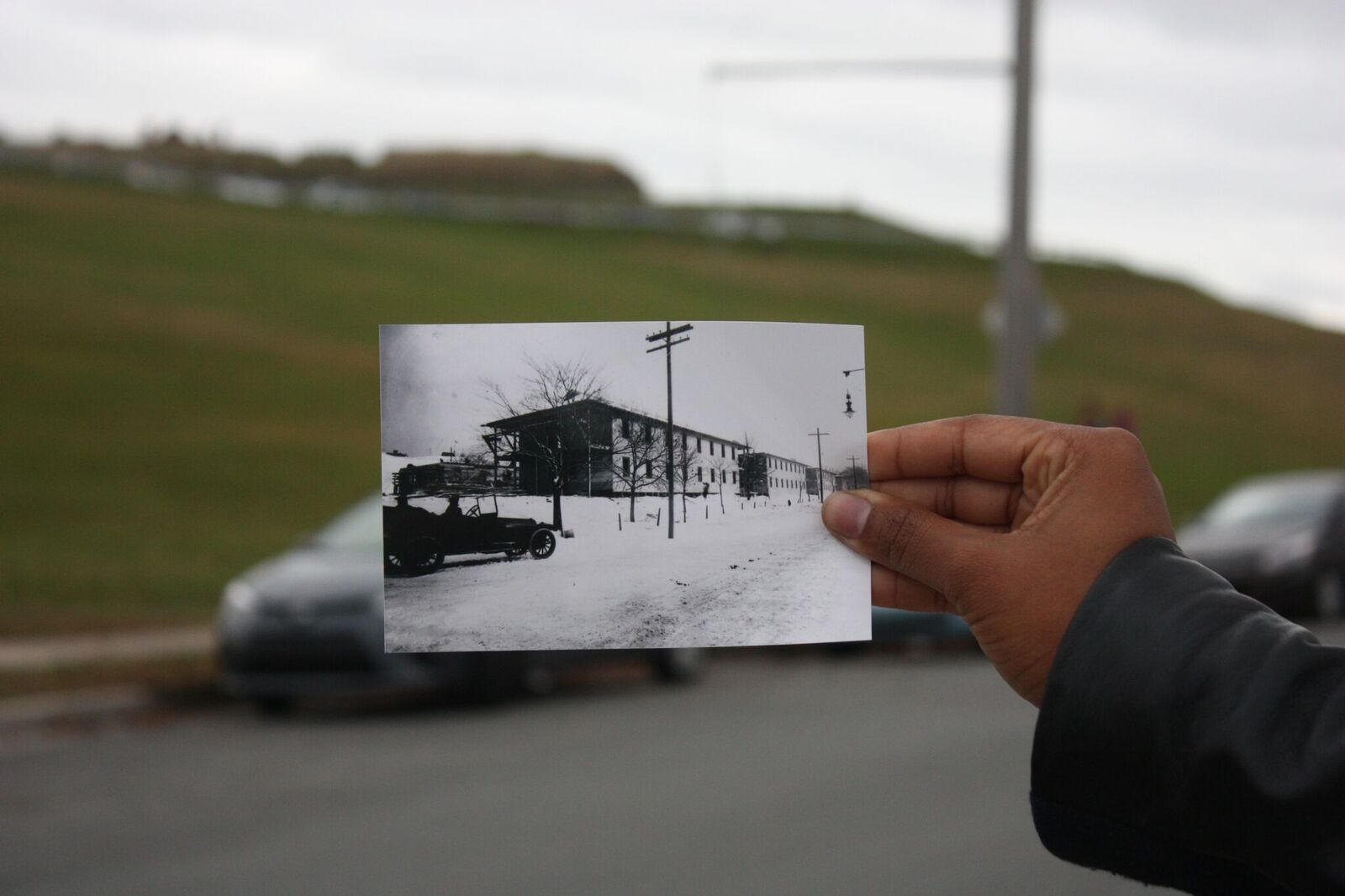
Temporary housing for those affected by the disaster was constructed on a location beside Citadel Hill, on Bell Road. The buildings were later demolished, when they were no longer needed.
caption
Worker housing being built near Citadel Hill. Inlaid photo: Nova Scotia Archives.The Halifax Relief Commission was charged with redeveloping the devastated area and providing housing for people displaced by the disaster, among other roles. This house on Livingstone Street was typical of those erected by the commission. Albert Crawley, one of the two men pictured in the “before” shot, lived in this house after it was built, according to the 1919 McAlpine’s Halifax city directory.